Welcome to WordPress. This is your first post. Edit or delete it, then start writing!
Going Ultralight
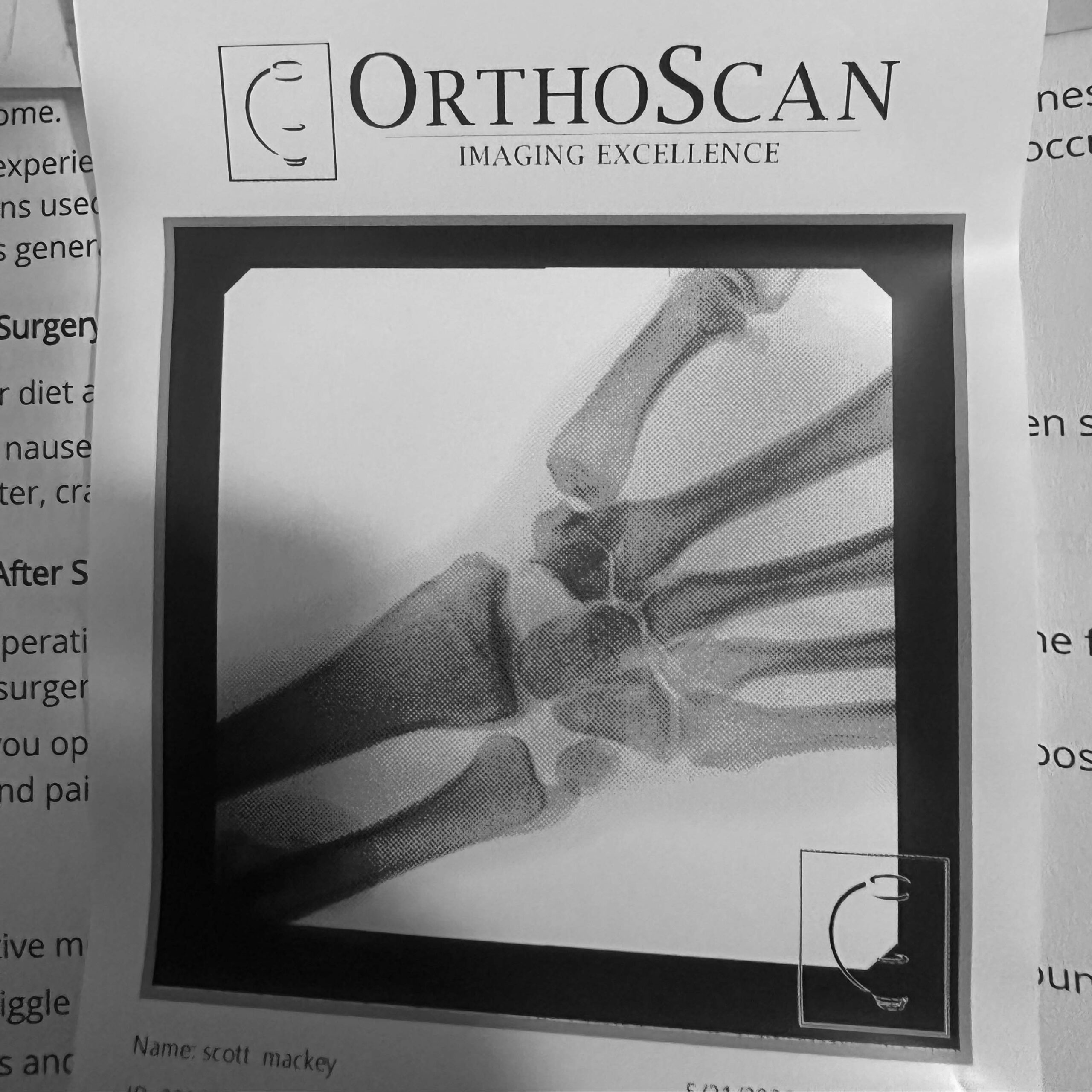
Four years ago on a warm June morning, I had just finished volunteering as a paddle boarder keeping swimmers in check during the Couer d’Alene Ironman, a race I had completed a couple of times myself. Skirting along the shore heading towards where my car was parked, my fit caught a rock and I was thrown off into the shallow water.
Only about three feet deep, there wasn’t enough water to slow my fall; I landed on my wrists and holy shit that hurt. Thinking it was just a bad sprain I iced it and touched it out for a few weeks. It got better and soon enough I was back to cycling and climbing and normal life.
But then after a few years, the pain came back with vengeance.
Again, I just dealt with it for awhile until riding my bike became too much. A nasty wreck on a gravel road because I was riding one-handed sealed the deal: I was no longer bike worthy and it was time to figure this thing out.
Turns out, that paddle board fall a few years back both broke my wrist and blew up a tendon in my hand. The tendon keeps some of the wrist bones, which kind of float in space, lined up and functioning. Mine had moved all around and were no longer useful. Wrist reconstruction was needed to remove those three bones and rebuild the joint with a different bone.
Lesson: go to the fucking doctor if you think you’re injured.
Pistils and Decay

[rl_gallery id=”2120″]
Three First-Activations in Northern Idaho
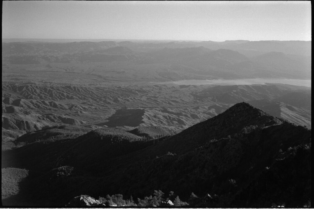
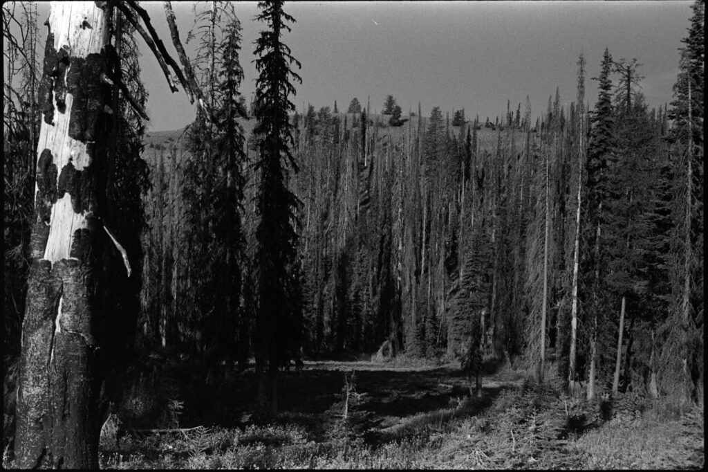
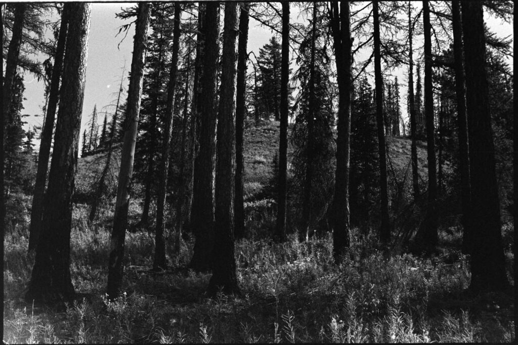
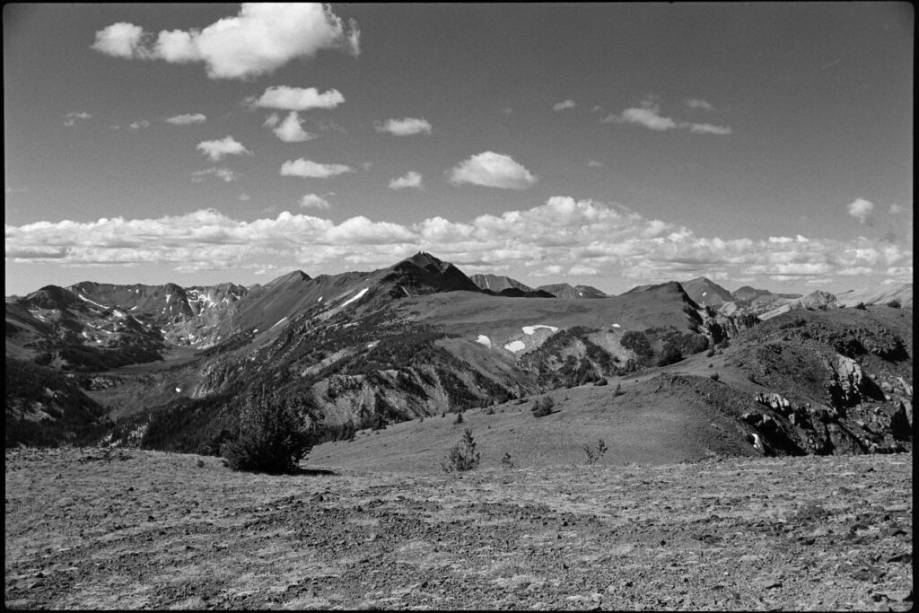
Most winters necessitate late-May to early-June starts for bagging some of these deep-in-the-forest peaks in Northern Idaho. Negotiating the mountains themselves generally isn’t too bad, but given the forest road conditions it’s just not possible to get close enough to access things, unless you’ve got a snow machine. My Honda Element doesn’t quite cut it.
This very mild winter we just had was absolute hell for the ski resorts, but it meant I could make some attempts on my W7I hitlist much earlier than normal.
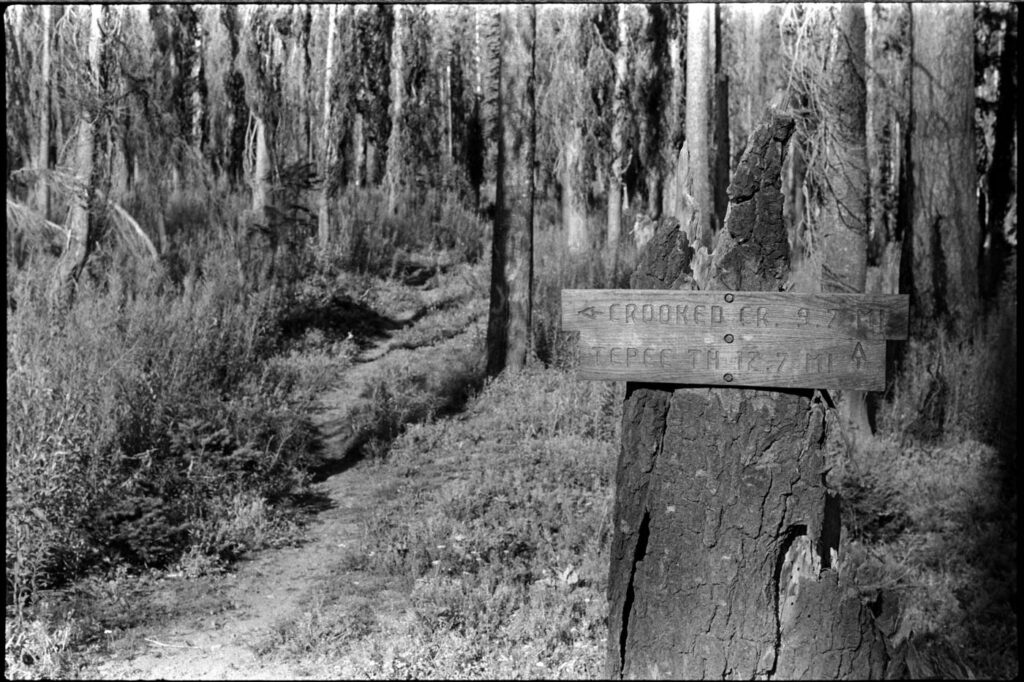
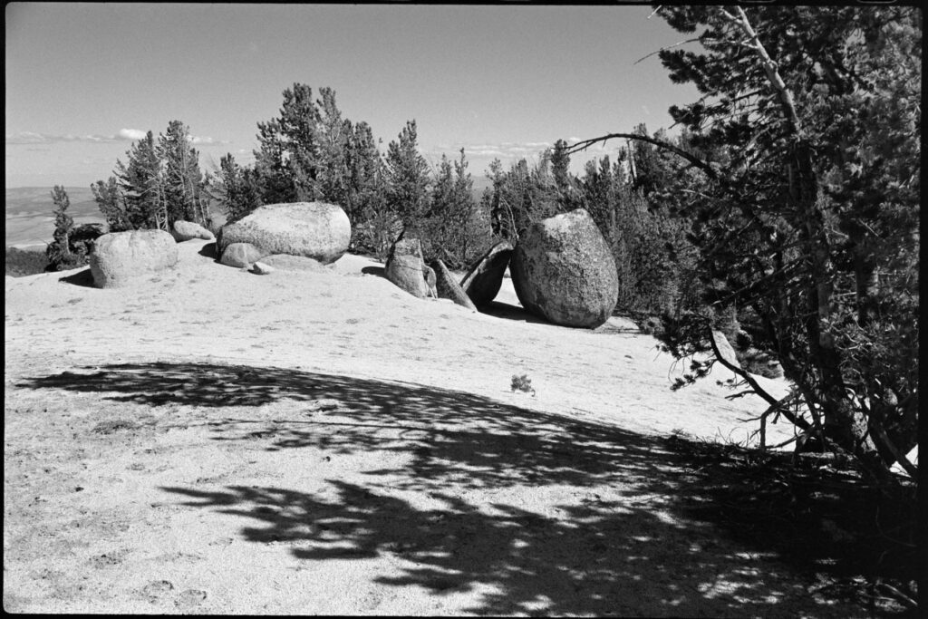
The first one to fall was no-named hill 4634 outside of Elk River: W7I/NI-253. I tried for this one a couple of weeks prior, but about an hour into the drive and my 230k mile Honda began pitching a fit so I had to abort. Well, now that the SOTA-wagon is fixed up it was time to go for it again. Parking at the point where I could no longer drive, I hopped over the snow burm and my first dozen steps sank me mid-shin deep into crunchy snowice. That wasn’t going to work.


Lucky, I my trekking skis still up in the Yakima gear box. Slapping those things on, I easily made my way about a mile and half up the snow road to the base of the mountain. I jammed my skis into the snowbank, strapped on the microspikes and climbed up into the AZ.
Band conditions were not great. I spent about 90 minutes operating and only got 3 contacts before daylight and cold convinced me to head back down. So no, I didn’t get my hard-earned one point but I did activate the summit and to me, that was worth even more.


Back down to the skis, I glided (sorta, it was icy) back to the car and called it a success. Any day you get to goof around in the backcountry is a good one.
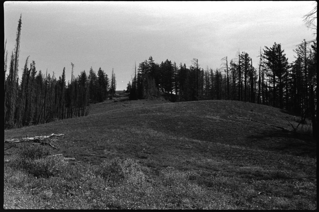
A couple of weekends later the temps were bumping even higher. It was Easter Sunday and there were two summits in relatively close proximity to eachother that I’ve been eyeballing for over a year. Unactivated and difficult to get to as they’re deep behind logging access gates, I had a full day’s worth of water and snacks packed expecting to log a shit ton of miles.
As I rolled up to the access road, my eyes widened as I recognized a wide-open gate–something I have never seen in the dozen or so times I’ve passed by this entrance. This was indeed going to be my day. I entered and happily, but cautiously, drove in towards the first summit.

I never did encounter another person or obstacle, though the driving was still slow and tough given the road conditions. Both of these summits were pretty straightforward ascents. Nothing too shwacky and just long enough to get a bit of a sweat on.


I grabbed 6 QSOs and then packed up determined to go nab the second one. Who knows if/when I’d ever be able to drive in this far, so today needed to be the day I go for both of these.


So after nothing in February, I bagged three FA’s in March plus a 6+3 pointer with Mount Spokane and the winter bonus. My CW is still rough but I’m loving it and it’s passable. On to April.
Monte Has Entered the Chat
February was a wild month. Within the first week we had our water heater fail–rather catastrophically–and flooded the downstairs (which includes ou r bedroom). That’s ongoing, Also had a bit of a vehicular hiccup with the SOTA rig, a 20-year-old Honda Element, that cost a pretty penny. But thankfully it’s running great with 230k miles.
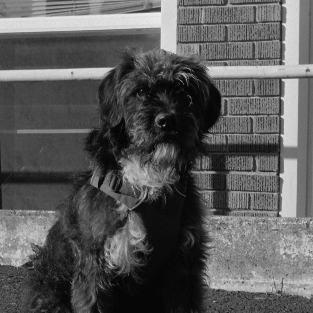
The true highlight of the month was our welcoming of Monte to the household.

We adopted this sweet guy from a rescue over in Edmonds, WA. He’s about 2 years and fully of energy! The guy has is pretty reactive when he sees wildlife, so it’s going to take some time and work to bring that down but he’s super smart, and food motivated, so I have no doubt he’ll figure things out and be a great hiking buddy.
New Year Thoughts (Doing Hard Things)
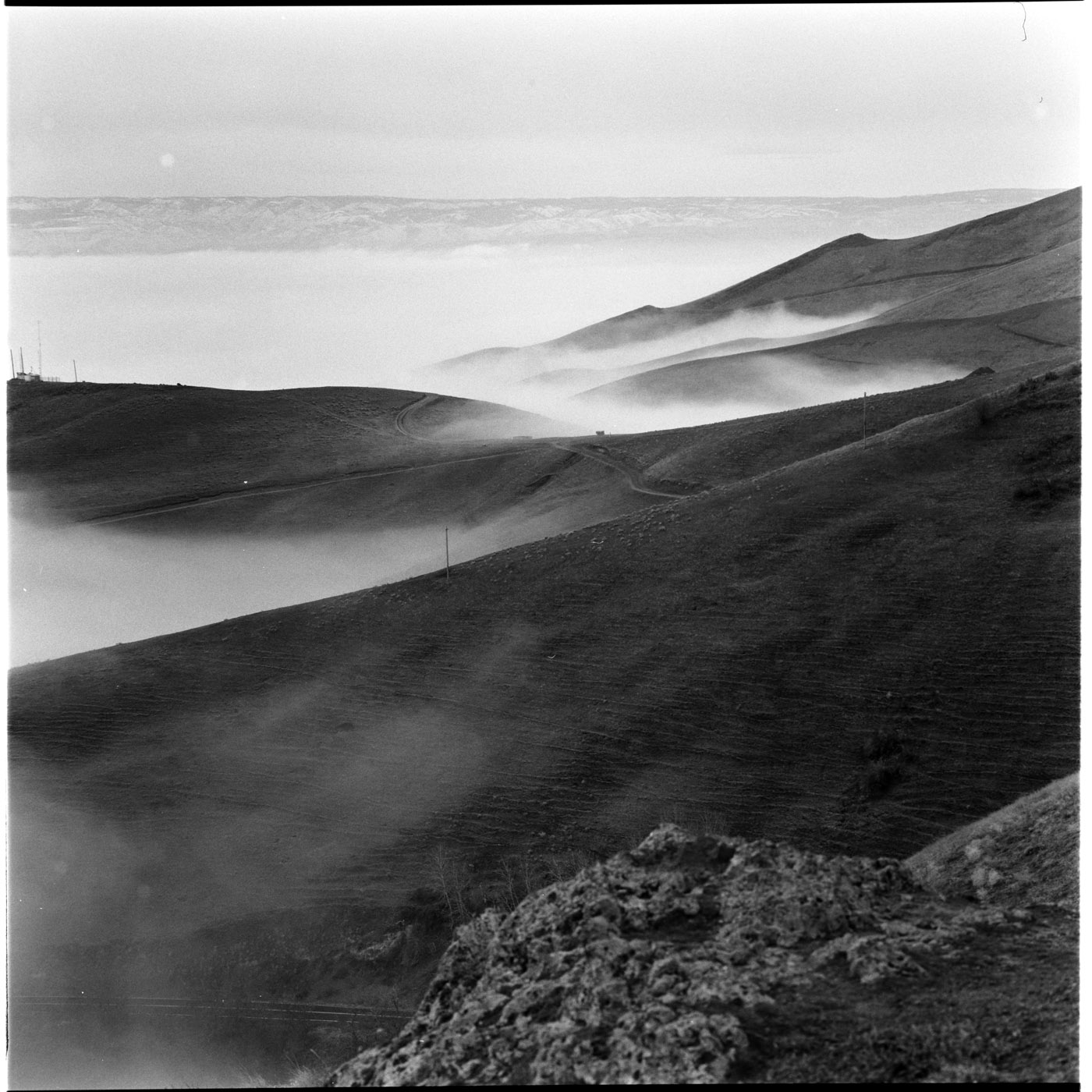
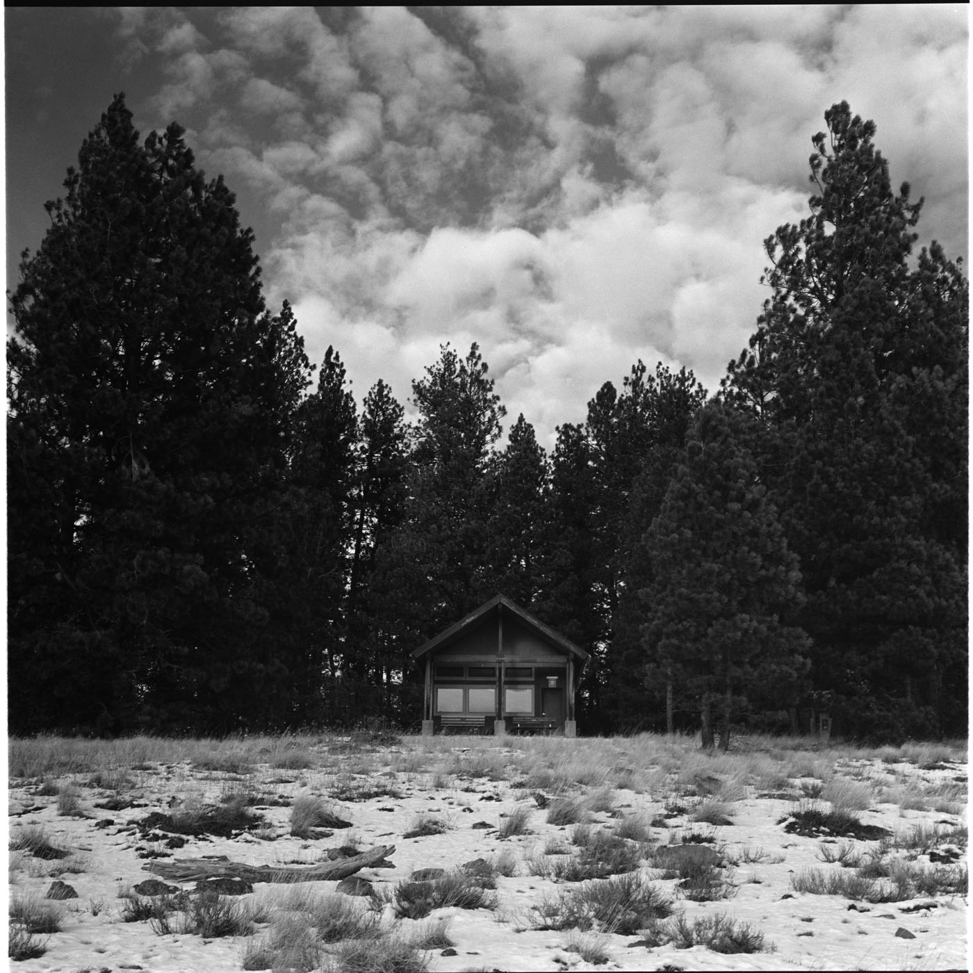
It’s about 30 degrees outside and I’m currently in my sleeping bag in a cabin at Field Springs State Park in SE Washington. Earlier today we celebrated the end of 2025 with a hike, some snacks at altitude, and a summit activation (for me, at least).
When the year officially rolls over (00:00UTC) all of the SOTA summit yearly points are reset, so a ton of operators go out and bang-bang a summit in both 2025 and 2026.
Field Springs State Park isn’t too far from me, about a 90-minute drive south. In the winter it has groomed XC and snowshoe trails, complete with a warming chalet right up on the summit. I booked a cabin in the park hoping we could backcountry ski or snowshoe up to the hut but the unusually mild winter didn’t quite accommodate. A simple snow hike would have to do.
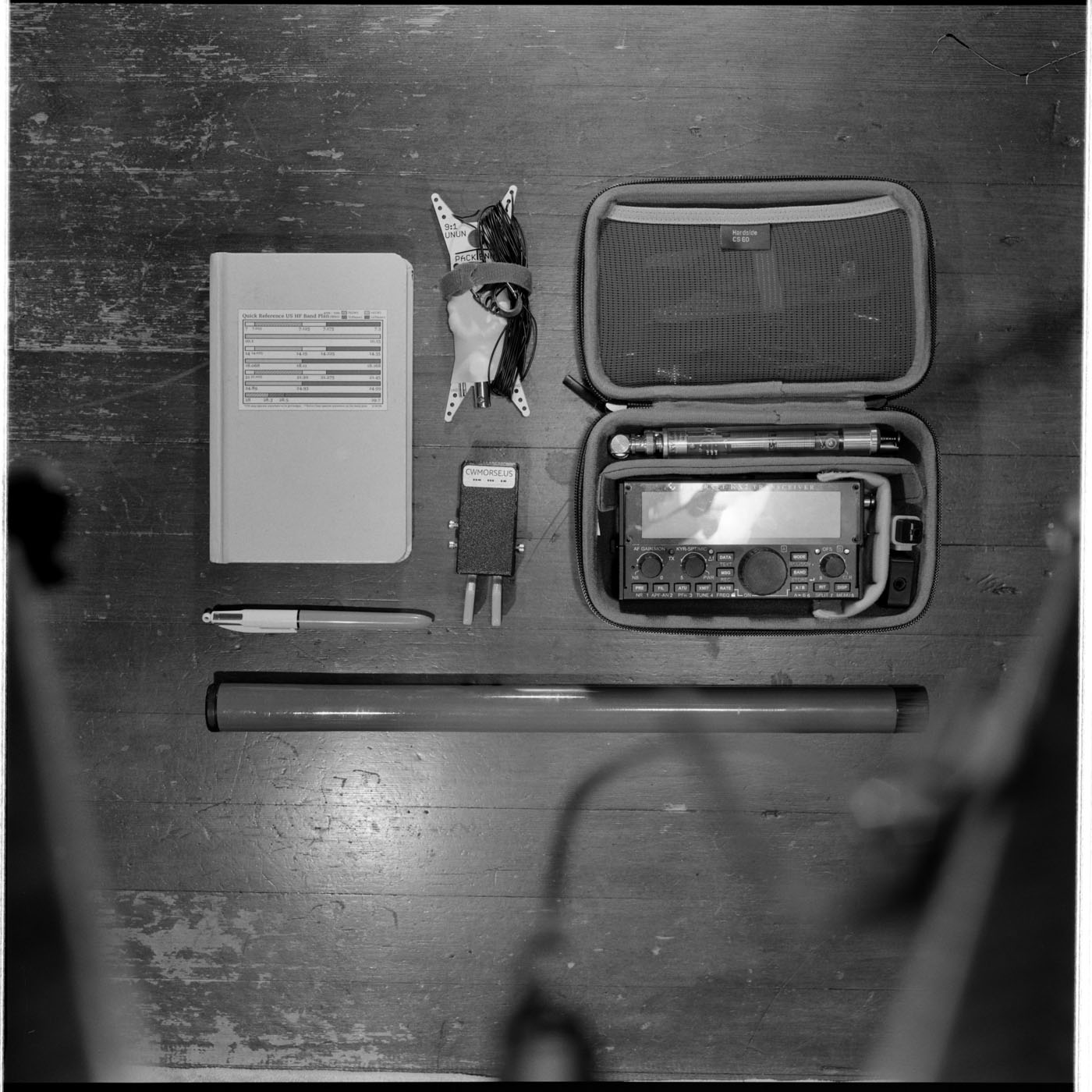
Up at the hut, Corrie made a fire in the stove while I set up my antenna and snapped a few photos of the surrounding canyon. The views are pretty amazing, esp at sunset.
I cracked open an Aperol spritz and after spotting myself on 7.063 was fortunate to have several chasers come back to be nice and S-L-O-W. This was only my second CW attempt on the air, but it went relatively well. Better than the first time. I banged out a few more QSOs on SBB and then waited for the hour to flip. A few more to re-activate the summit in the new year and that was that.
Time for dinner. We packed small meal of nuts, olives, smoked salmon, and a baguette. Oh and that bottle of Cava that was chilling outside in the snow. We played a few rounds of card games and called it an early night. Now I’m just scribbling out some reflections and hopes for the year ahead.
Along with the year tick-over, I’ve also recently turned 46. Holy shit. Time is a fast-mover and I can’t help but to feel like I need to keep making the most of it.
In past years I’ve set a few large goals that required months and months of preparation to achieve. Ironman races, multi-hundred mile bike rides, complete shifts in careers… that kind of goal-setting is not only exhausting but is also risky. If you miss, it can feel like a total failure.
I’m going to lean more towards a consistent series of “hard things” sprinkled somewhat evenly throughout the calendar. Surely, not all will end in success, but they should all make be a slightly better person by the time I hit 47.
Goals I’ve Concocted for 2026:
- read 26 books
- amateur extra radio license
- Log 260 CW QSOs
- W7W/WE summits: reach 26 total activations (currently at 12)
- W7I summits: reach 26 total activations (currently at 19)
- run a pb at the seattle marathon (26.2 miles)
- shoot *more* film (buy *less* cameras)
- personal summit list (bag more of ’em)
Some of these are quantifiable, others are feelings, and a couple are intentionally vague. I don’t want to be more busy, rather I want to be more intentional with my time. Let’s see how that goes—I might just spend my weekends drinking beers and eating sandwiches.

I originally took on K2VFZ shortly after earning my Technician license. The 7 call area covers much of the Mountain West, which fits my time in Arizona and Washington. My grandfather (K2VFZ sk) also held a 7-area callsign after moving from New Jersey to Arizona in the early 1980s, so K7VFZ ends up as a natural mash-up of the callsigns we’ve both held.
Arizona Madness
Summit One
Most years, the first Saturday in October is the Ten Point Madness SOTA event for W7A (Arizona). Operators head out across the state to get on top of a 10-point summit where they’ll rack up a ton of simplex S2S contacts with each other before getting onto HF to chat with chasers further out.
Seemed like a good time for me head back to The Valley to see my family–so I packed my bag full of radio & hiking gear, leaving just enough room for “normal person” necessities, and headed south.
The summit I picked was Browns Peak W7A/AW-014. This is one of the Four Peaks that rise up in the sky west of Phoenix. Everyone knows of Four Peaks, in fact, my favorite brewery is Four Peaks. While working at the local rock climbing gym in college,noften after we closed up, we’d scale the wall behind the gym (of course we slyly installed holds) and would hit up Four Peaks for a couple of pints and a flat bread. We’d talk about past and upcoming adventures, sharing beta and dreaming up new challenges.
Crazy enough, in all my years of Arizona exploration I never went up to see the peaks I was otherwise so familiar with. Better late than never.
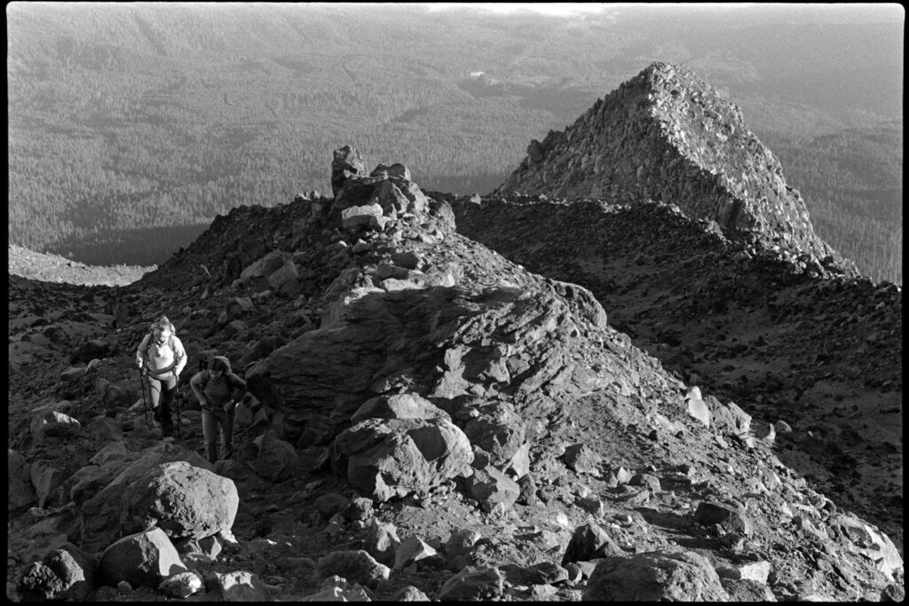
The alarm went off at 1:30am Saturday morning and I was out the door by 2:00. The time to be on the summit was 14:00 zulu, or 7:00am local. Driving was going to take a couple of hours and the hike, although a short three-ish miles, included a pretty decent class 3-4 scramble.
Starting a hike by headlamp is generally a sign of a solid day ahead. It was dead quiet out there except for the one largish animal I woke up (I couldn’t ID what it was) and the whispers I heard at one point, which still gives me goosebumps as I think about it. The mind can play some wicked tricks.
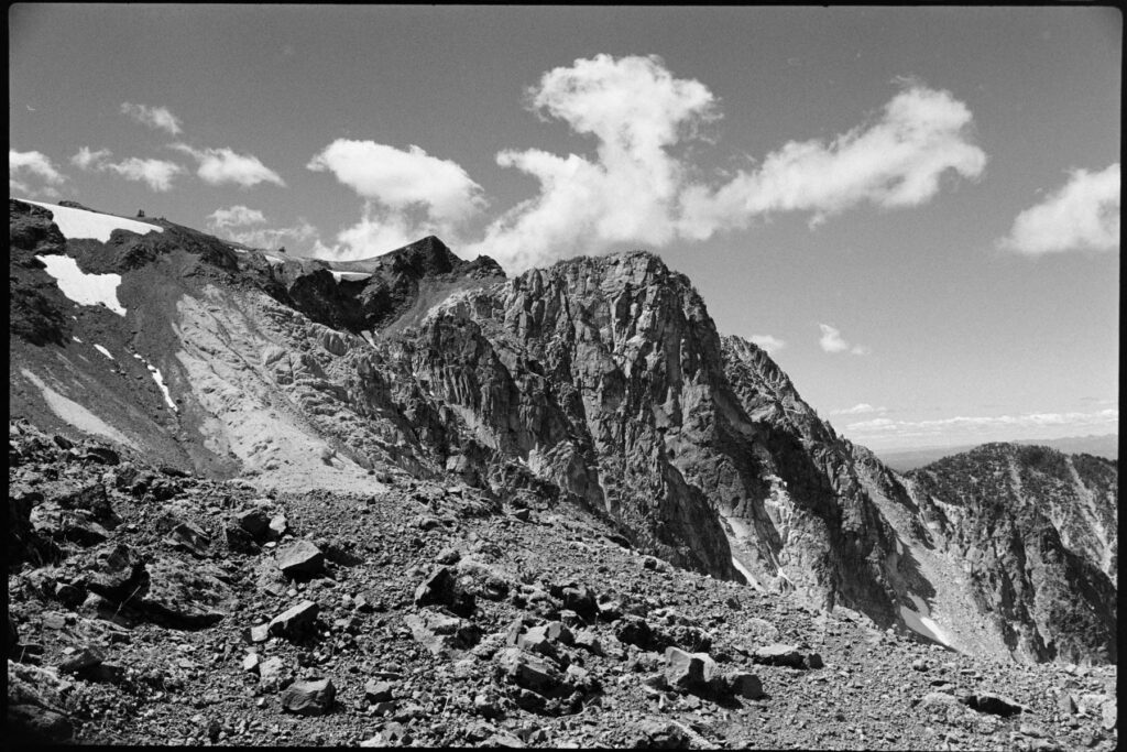
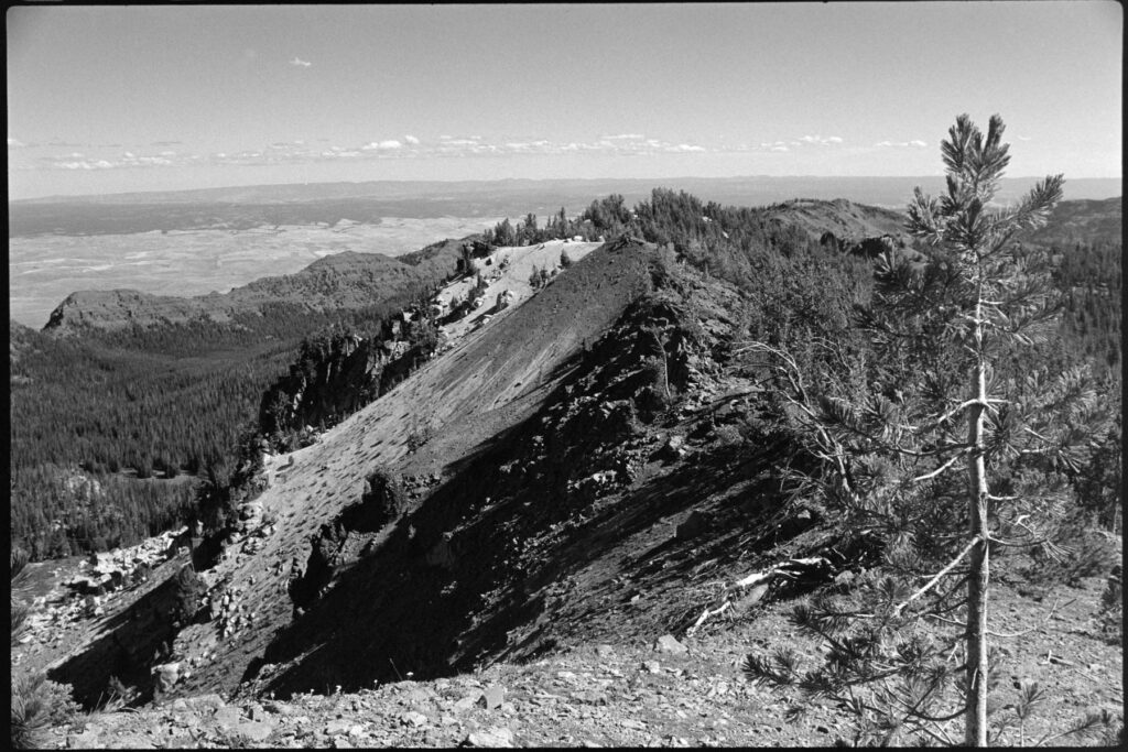
As daylight began to creep on the horizon, I got to what is referred to as “the chute”. This was the scramble section and it appeared proper sketchy at 5:30am. But as usual, the closer I got to the rock the less scary it was.
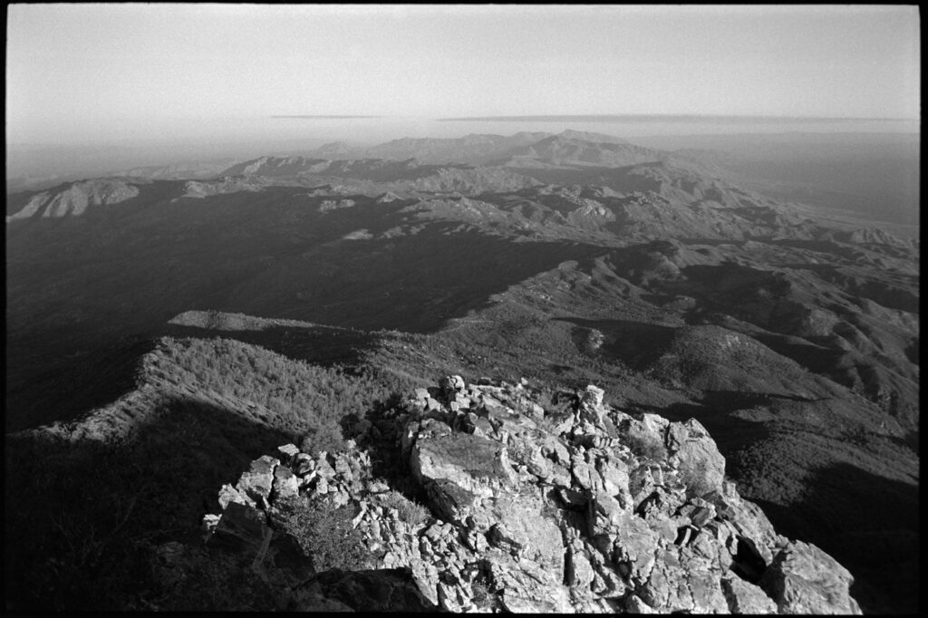
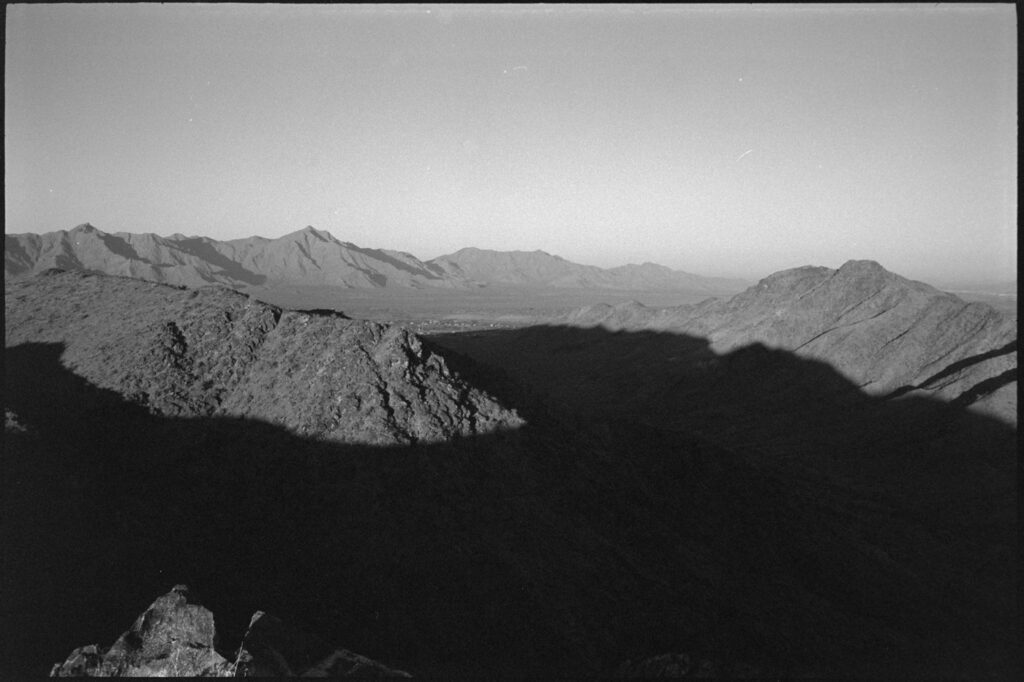
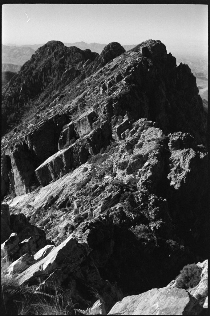
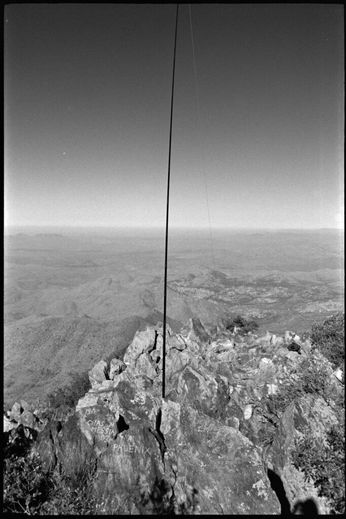
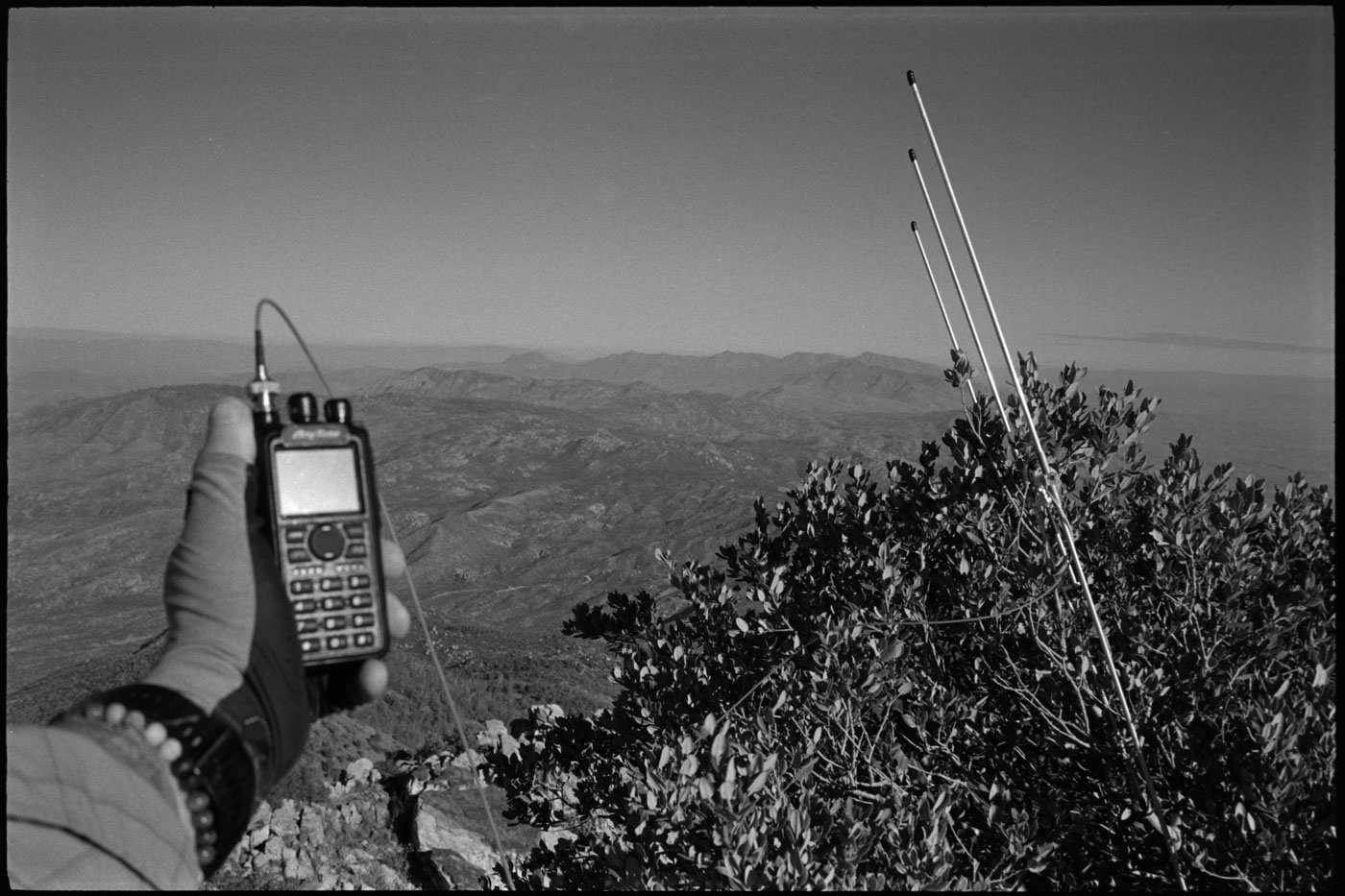
Three hundred sixty degree views at the top were incredible and I couldn’t have been more stoked to be back in the desert. Unfolding my three-element yagi antenna and affixing it in a bush pointed north-west, my HT radio was on and I sat admiring the landscape and monitoring the airwaves. Just after 7:00, 144.41 became alive with summit to summit calls. I waited for bit to let the locals have their fun (I felt a bit like the foreigner) and once things slowed a bit I clicked my pen and jumped in the fray.
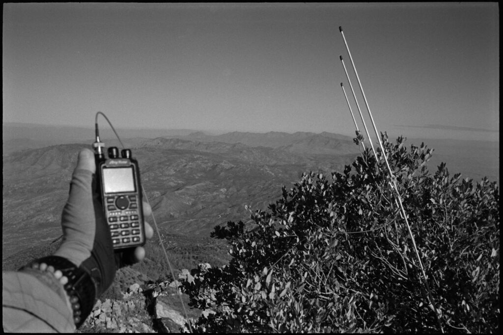
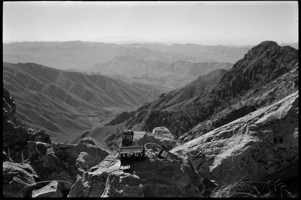
When all was over, I had 29 QSOs with 16 of those being on VHF. That includes an 89.2 mile summit-to-summit on 2m simplex with Fred N7PN. Pretty rad.
Summit Two
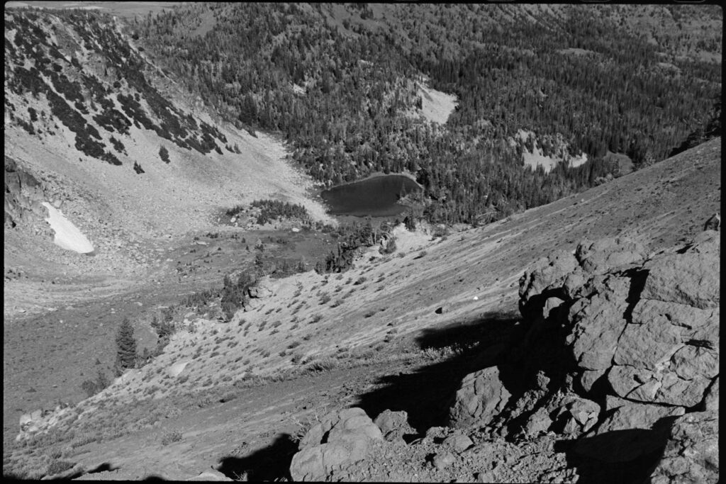
After hustling online earlier in the week, Wednesday was opening up work-wise so I took the opportunity bag another a local one. The highest point in Maricopa County seemed like good option, so out to Lost Dutchman State Park I went. The trail is more commonly used to reach “the flatiron”, which I had done a couple of decades before, but today I was aiming a bit higher.
Route-finding, even with my GPS map, was interestingly difficult. I wandered off-trail once or twice and would have to make my way back over. Lots of rock hopping and all of it was steep. The couple of times I stopped for a breather were cut short by swarms of mosquitos.
At the saddle you can make your way over to climber’s right for the flatiron viewpoint, or go left to scramble up some more in order to gain the high point of Superstition Peak W7A/PN-022.
Summit Three
This was an early morning, headlamp trailrun in an attempt to bag a summit (Goat Hill W7A/MS-065) before logging onto the computer for the remote workday. A “revenge activation” so-to-speak. Goat Hill was my first-ever SOTA attempt back in April 2024 when I was a Technician with exactly zero personal QSOs outside of a repeater contact or two.
This time, I had the tools and I had the talent (to quote Winston Zeddemore). Success came easy this time with a quick run of 2m contacts. Because I brought my KX2 along, I figured I’d might as well give it whirl so I did a super rudimentary antenna setup (tossed my wire down over the cliff edge) and got one QSO from W0MNA.
Good enuff. Over and out.
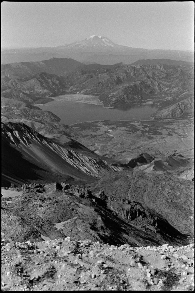
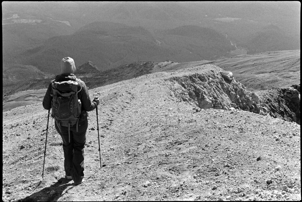
Mount Saint Helens

The summit that started it all. When 2024 began I had no knowledge of SOTA and only a vague familiarity (but zero interest in) ham radio. For whatever reason, YouTube began to feed me some video about ham radio and a volcano. I vehemently ignored it, perhaps even clicking the “not interested” option, but the algorithm persisted.
Finally I gave in and my eyes went wide with curiosity—there was a guy scree-surfing on top of a windy Mount Saint Helens with a handheld radio talking to someone else [turns out] on another summit. I didn’t know what I was watching, but I knew that I wanted in on it.
About 16 months later and here I am leaving the Climber’s Bivuoac trailhead with three partners, a ham radio license and a rough plan.
The ascent up Saint Helens can be broken into 3 segments: the forested trail, the boulder field, and the sand/ash climb. With headlamps and snacks, we started right at 5:30AM hoping to reach the boulder field before sunrise.
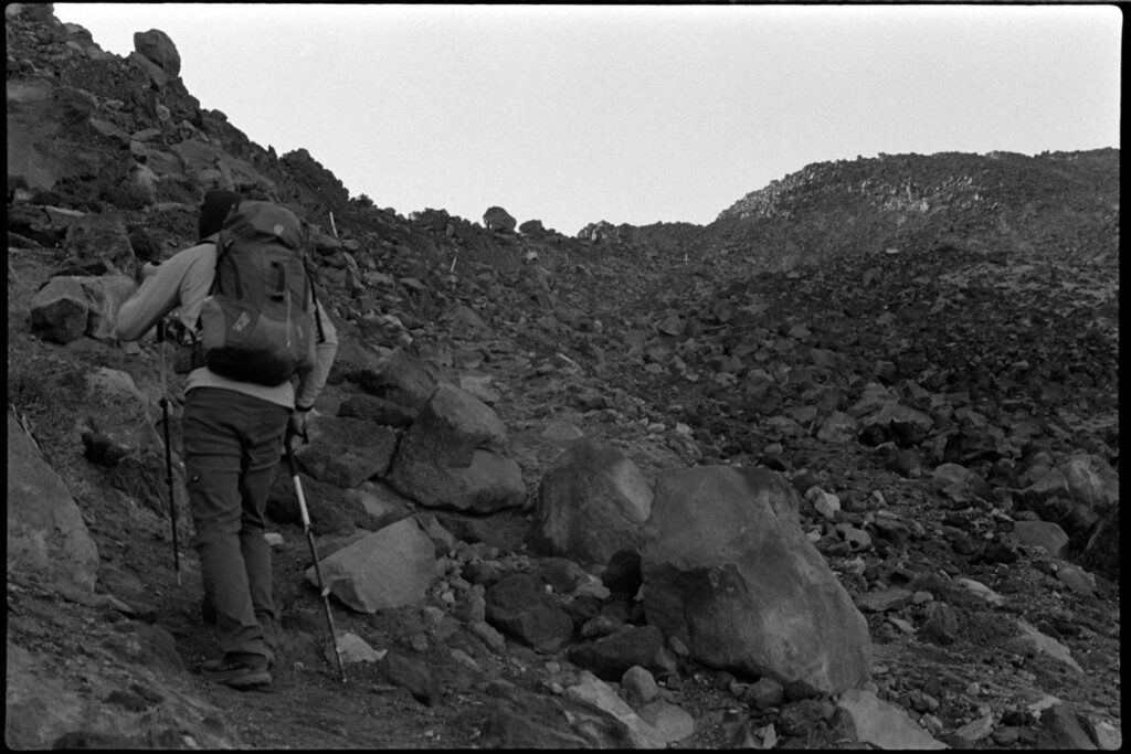
Route-finding is not a problem, with tall wooden poles marking the way up. We kept a consistent pace up with only a couple of short breaks to occasionally take in the view and swap out clothing layers.
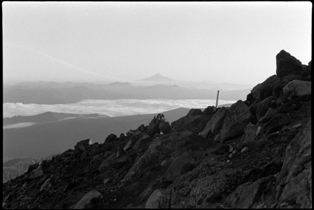
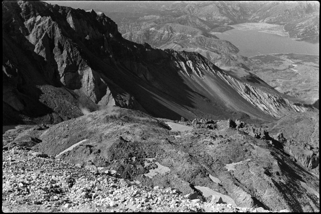
It took us a bit under four hours to reach to the top where we had to then hike along the edge to get up to the true summit.
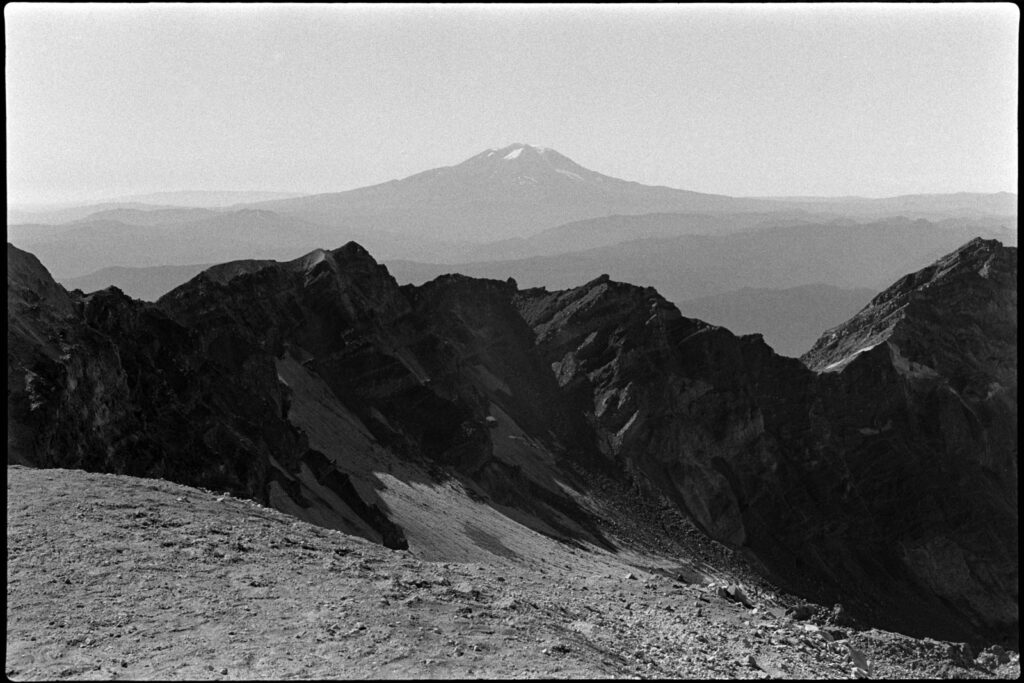
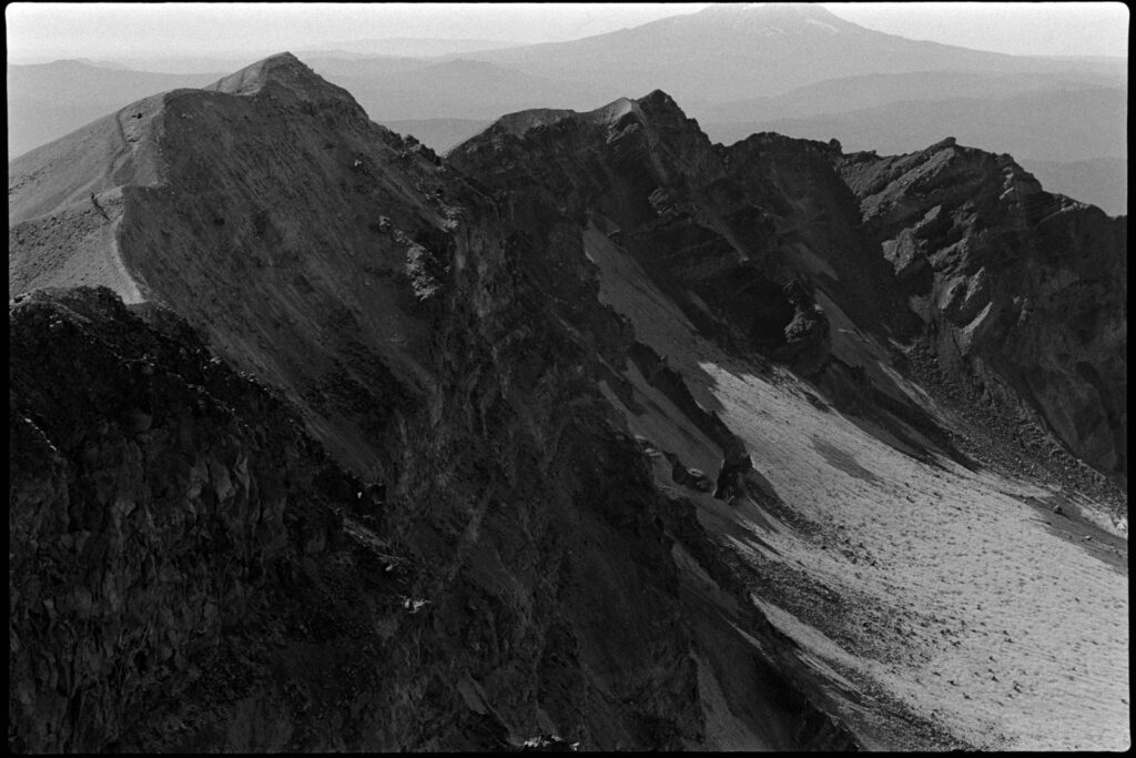
Using my Anytone 878 and a Smiley 2M whip, I made 11 FM contacts and easily activated my first volcano. We sat down to eat our sandwiches and just look out at the other mountains, feeling lucky on this incredibly clear day.
Finally, it was time to head back down. We had a bit of a drive ahead to our hotel in Hood River… and the beers & burgers at Pfriem Brewing were already sounding pretty damn good.
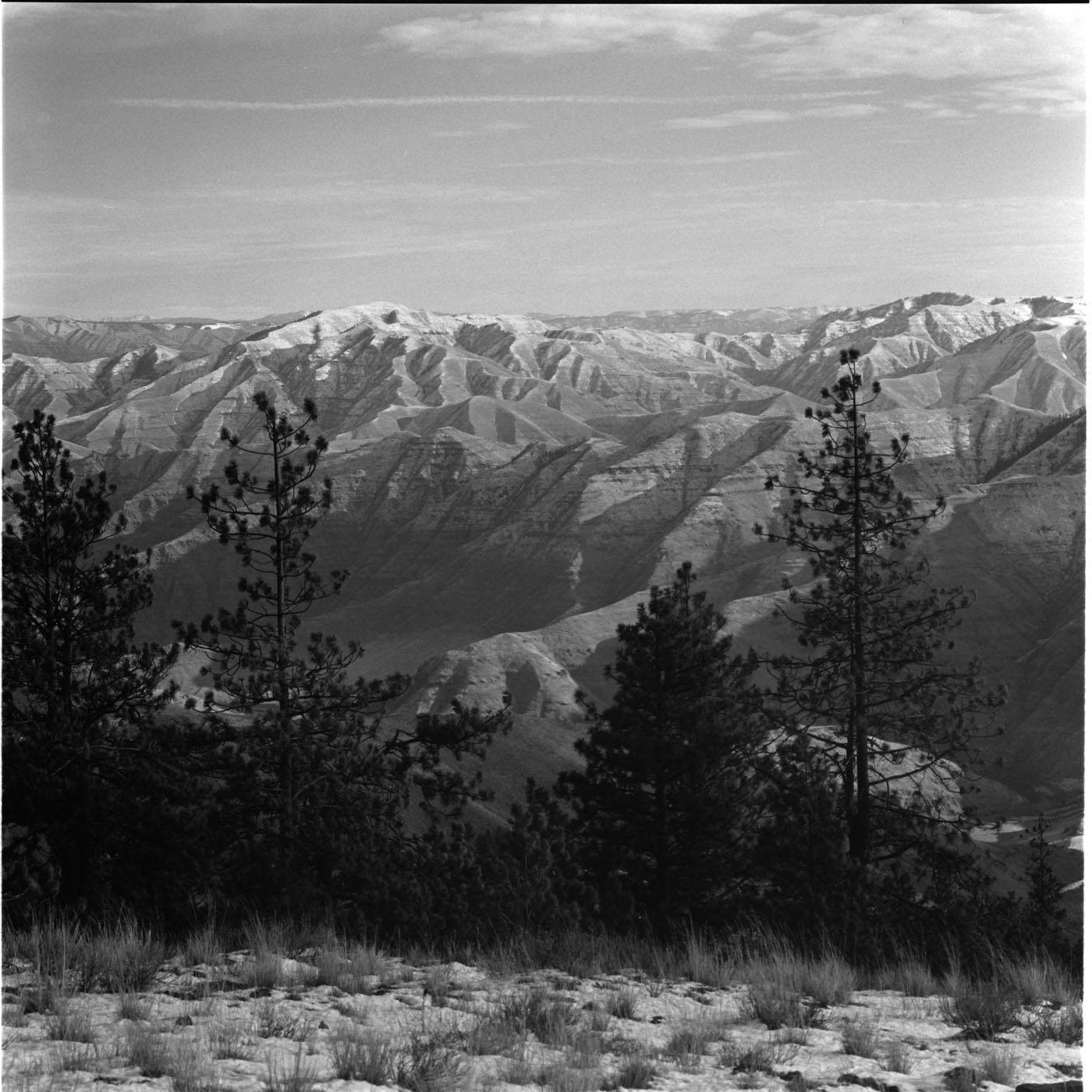
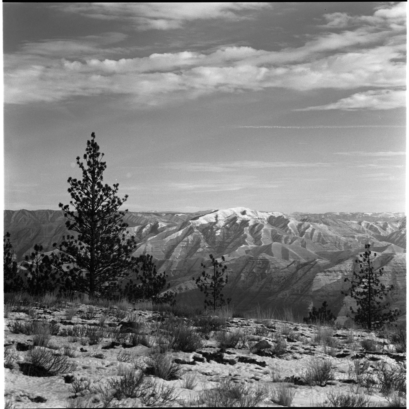
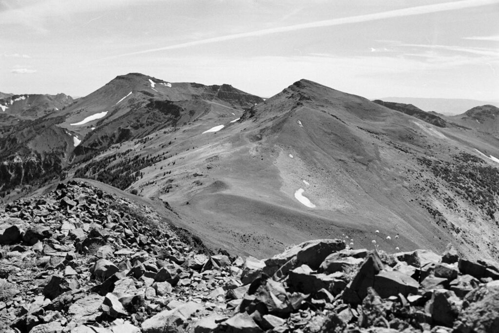
Blue Mountains: Misery Peak W7W/WE-003 & Garfield County H.P. W7W/WE-002
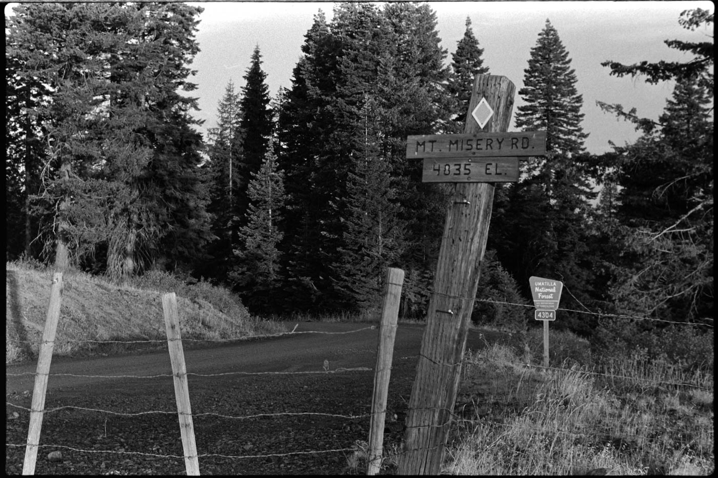
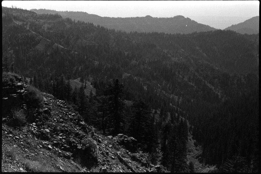
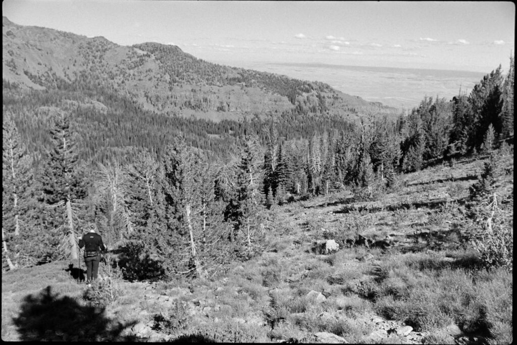
This is a bit of a scouting mission as I’d only been to the Blue Mountains a couple of times and those were the pre-summit hunting days. Two relatively easy looking targets: Mount Misery W7W/WE-003 and the Garfield County High Point W7W/WE-002.
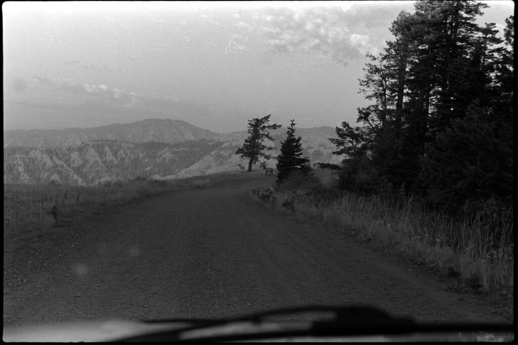
Happy to report that the Umatilla National Forest roads were surprisingly wide a smooth, making the long drive to get into the business bearable. As you get closer to the summits, the road does begin to narrow and roughen, but nothing notable.
Garfield County High Point was first up and was a relatively easy trail hike from the parking area below. The activation zone was wide open with some nice views, especially to the south-east.
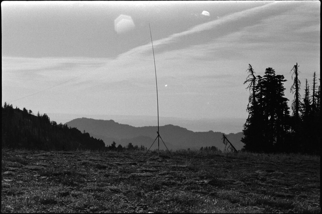
After that clean activation, I made my back to the car and then relocated a bit closer to Mount Misery. There was a nice pullout along the otherwise narrow section of road just below the summit. The hike up was steep with no trail, but straightforward.
I spent a fair amount of time looking south towards unactivated Prominencians Peak W7W/WE-013 and Halsey Butte W7W/WE-010. Both have been on my radar for quite some time and although I didn’t make it out this year, I’m hoping for a 2026 attempt. The terrain looked to be super rough and overgrown—it’ll probably be a pretty difficult and long day for each.
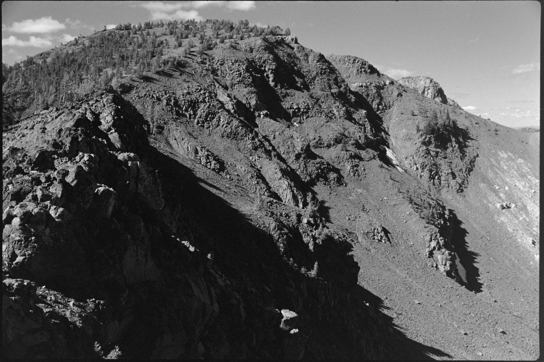
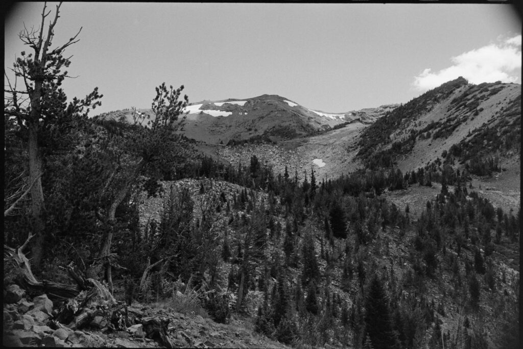
Traverse Ridge W7O/NE-017
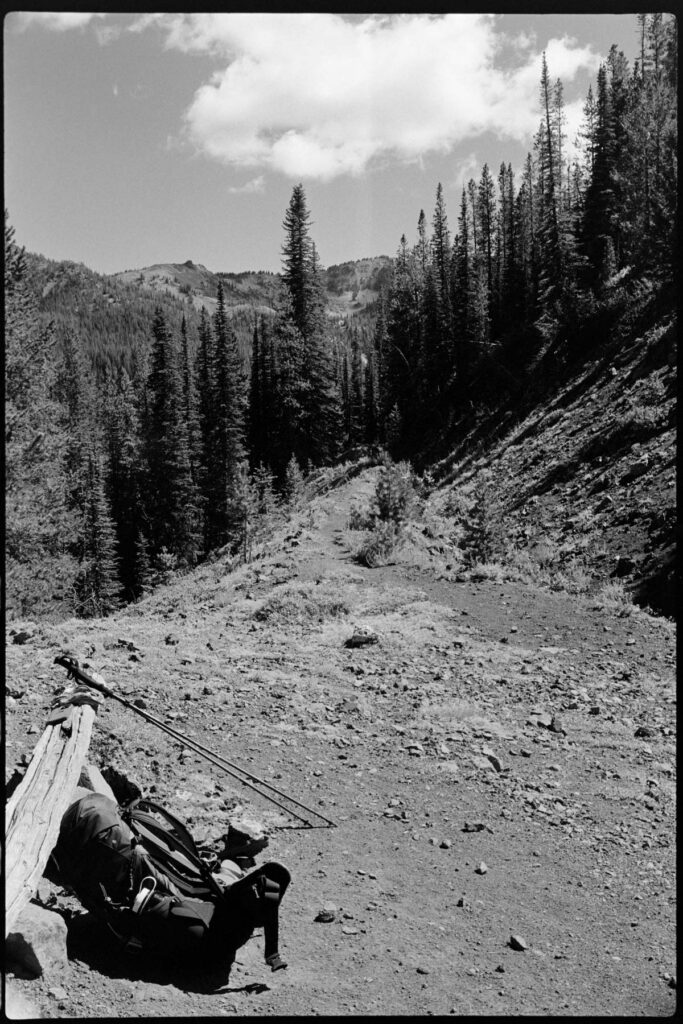
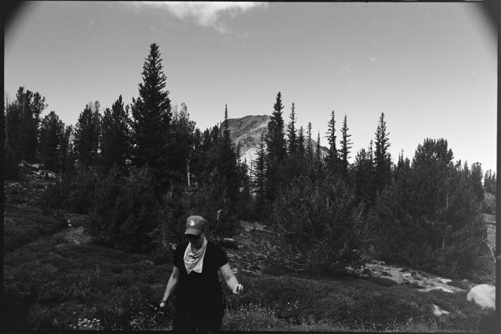
A tough week resulted in the hasty decision to head into the Wallowas of Eastern Oregon. We arrived at the Hurricane Creek Campground just before sunset on a Thursday evening to set up camp and crawl into the tent.
Up early Friday we made our way to the “trailhead” along Lime Quarry Rd 45.37808, -117.35148
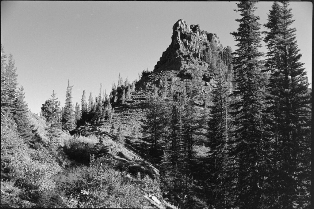
Immediately we were met with an hour or so of incredibly steep climbing until reaching the top with the most serene creek, a knobby spire to look at and a bench to have a snack on. From there it was the most enjoyable flat trail along a nice stream to the left with a drop off and views to the right. There was an opportunity to camp at one point along this path which I may utilize next time.
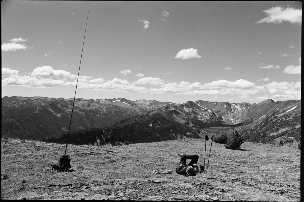
Then the trail fizzled out and the bushwhack began. Not really knowing whether we wanted to tackel both Ruby Peak and Traverse Ridge or just one or the other, we loosely followed someone else’s GPX track up to a saddle between the two. That climb up sucked the spirit out of us, at least momentarily. Ruby Peak looked easily doable but the return would be back down the way we came–and that wasn’t a fun prospect.
Traverse Ridge was a bit more daunting from our approach but it was 10 points (as opposed to Ruby’s 8) and it seemed like we could take the ridgeline for the majority of the return back to where we originally left the trail. Daylight was about to become an issue so we opted for Traverse.
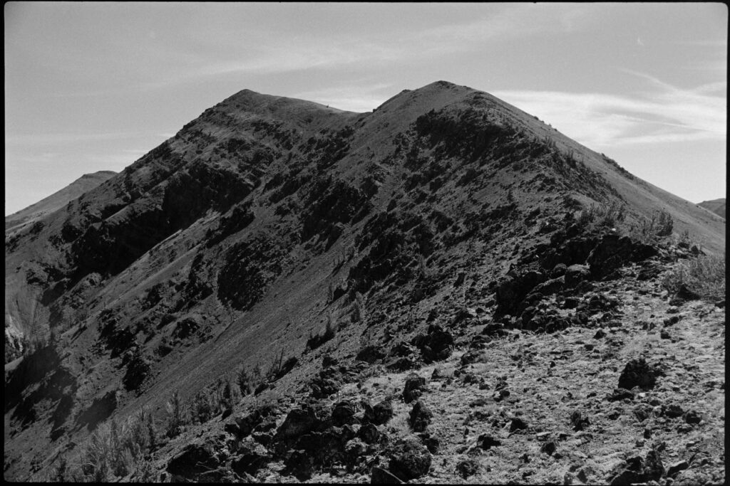
The scramble up wasn’t necessarily exposed, but it was crazy steep and a fall would’ve been really bad. We took our time and aimed our path up between two snow patches. Topping out was a great experience… the views were stellar and the summit itself was open and flat.
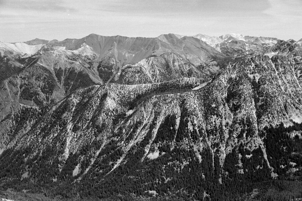
Many times, getting back can feel like the greater challenge. This was no truer today. The portion of our return along the ridgeline was incredible, full of impressive views and varied geography. But when it came time to leave the ridge and shwack our way back to the trail, this is when the fun stopped.
Corrie is a true badass. A former D1 rowing athlete with a 2k ergo best that stood at WSU for over a decade–she’s no stranger to the suffering. This hike had some endurance requirements, but it also had a fair amount of scrambly as well as a lot of swhack; and she’s not a fan of either those. But she powered through all of it and we ended with a real solid day behind us that we’ll remember for quite some time.
I had two different GPX routes to reference for our return and I don’t think there’s necessarily a good way to get off this ridge without a decent amount of suck. You just gotta pick a line, move, pick a new line, and repeat.
Note: I dropped a pin on the map labeled as “up ridge” which is essentially at the top of the first climb where we stopped to snack. Would going up that ridgeline and following it to Ruby, then crossing over to Traverse be a better option? A few weeks after the fact as I write this, I seem to think the initial climb up to that ridge might be a bit sketch… but I’d be willing to consider it the next time I go out.